The maps here are a few examples from the Maps and Mapping at the Claremont Colleges collection found in the the Claremont Colleges Digital Library (CCDL). Thanks to funds donated by William Brownell, father of a Pomona College student, Special Collections was able to digitize 150 of our maps for easy online access.
Many items in our map collections spell out the settlement of North America in the languages of European settlers. Whether in English, French, or Spanish, map holdings depict the exploration and administration of the American West and Pacific coast from the years 1542-1949. Just as books are written with the author’s intent, many of these maps depict the land according to the mapmaker’s agenda.
Some cartographers would stretch and crop the land to fit their own politics. Spanish colonial administrators promoted the idea of California as a chain of islands called the Carolinas. This concept of the West Coast spread and was recreated by non-Spanish cartographers, in the case of the two maps below.
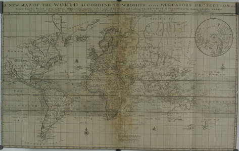
A New Map of the World According to Wright’s alias Mercator’s projection &c, an English map created in 1700 by Herman Moll. Note the California island.
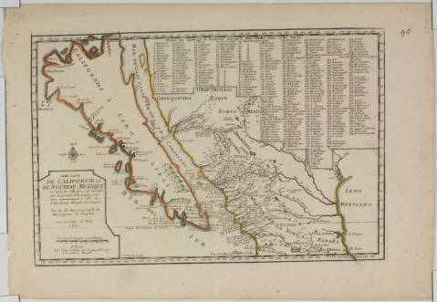
Californie et Du Noveau Mexique, a French reproduction of a Spanish map drawn for the Viceroy of New Spain, 1700
Even though maps from the late 1500s, like the one below, correctly show California as a southern peninsula and northern mainland, Spanish mapmakers spread the image of an island among other nations to avoid competition with the British. Not wanting to argue about the right to acquire new portions of the mainland, Spaniards simply claimed it was an archipelago. Colonial viceroys and mapmakers circulated this idea until King Phillip forced them to stop in the middle of the 18th Century.
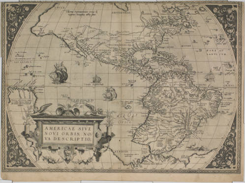
Americae sive novi orbis, nova description, by Abraham Ortelius, 1570. Note the peninsular California. Donated as part of the Henry R. Wagner Collection.
Other maps in this collection imply competition by later colonial powers. The 1811 American map below outlines towns, military outposts, and natural resources of Spanish Mexican states bordering the Louisiana Purchase. The detail of said locations likely reflects the cartographer’s interest in acquiring those lands. Given the Texan revolt and the Mexican war of the late 1830s and early 1840s, this may have become a common political opinion.
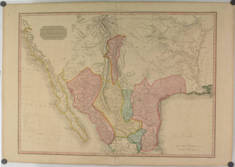
Spanish dominions in North America, northern part, by L. Hebert and John Pinkerton, 1811
Natural resources and landforms were key to settlers, as in the below map of 1850s California. The map outlines topography, cities, and mineral districts, all of which would have been important for settling in a nice place or striking it rich during the gold rush era. This map was composed from survey data by John Trask, California’s first state geologist. California was officially part of the United States at the time, and the huge amount of survey data on the map shows the Americans’ intention to stay for good.
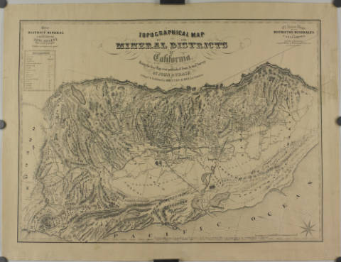
Topographical map of the mineral districts of California: Being the first map every published from actual survey, by John B. Trask, 1853
Just as this entry offers a glimpse of what is held in the Maps and Mapping at the Claremont Colleges collection, the digital collection only begins to reflect the collection of maps held in Special Collections. This digital collection will continue to grow, with the goal of increasing access to the resources available through the Claremont Colleges Library.
This entry was written by Special Collections Student Assistant Dalton Martin (Pomona College ’18).


